10 boat rides in 10 years

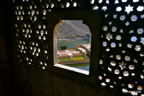
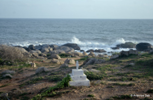
It’s now 10 years that I have been doing serious traveling (on work and on pleasure) and capturing those moments on digital cameras for posterity. I recall 10 memorable boat rides in these 10 years. Some rides are quasi commuting / public transport rides, going from one place to another in the quickest way. The others are more relaxed holiday joyrides.

1. Murud Janjira, January 2006

Janjira, January 2007 
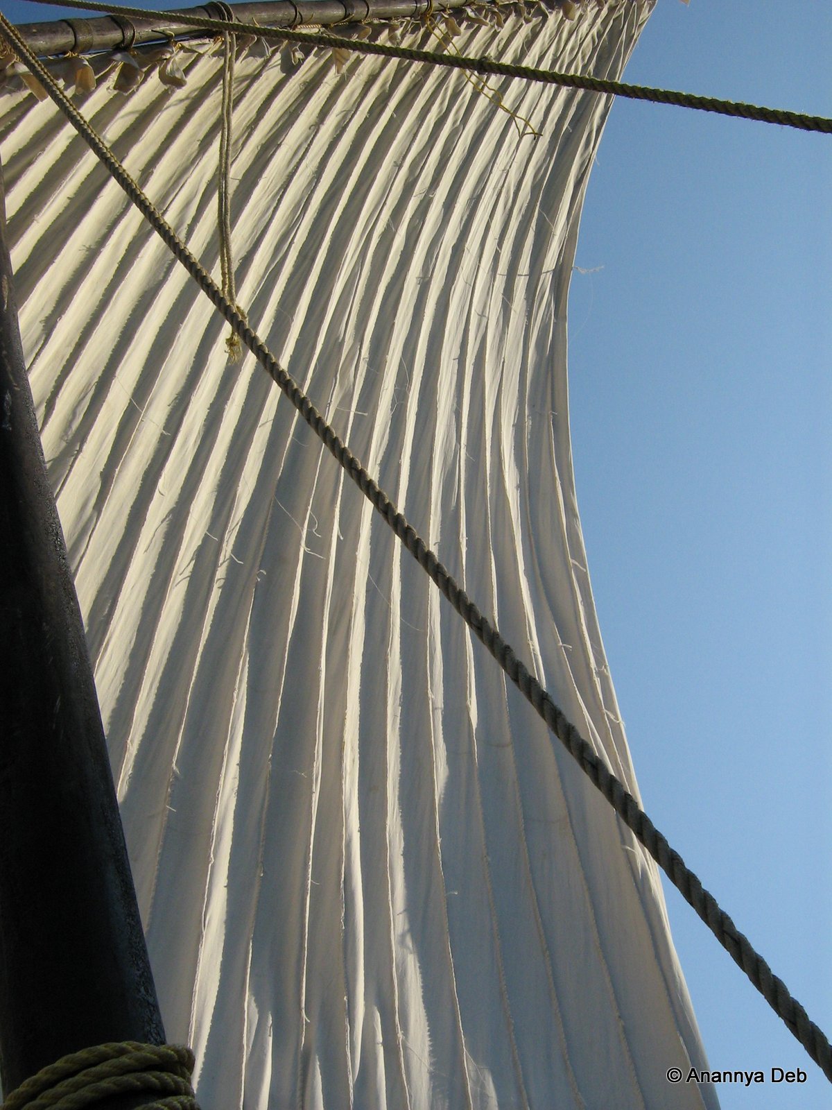
These are dhows, relics of the maritime history of the Indian Ocean. Ever since civilisation grew roots in the Indian Ocean rim – from East Africa, Arabia, Persia and the Indian sub-continent and the islands that dot the ocean – there have been various versions and forms of this simple craft. The Janjira island was an impregnable realm inhabited by Habisis – Abyssinians. These Habisis would have come to India in these very boats, brought in as slave soldiers purchased by the various sultanates in the Deccan. Those who were able to secure their freedom settled here controlling the Arabian Sea and protecting their allies, the same sultanates, from pirates and later the Europeans. Today, descendents of those Habisis operate these boats ferrying tourists from the main land to the fort – doubling up as guides and showing people their lost world.

2. Hogenakkal, September 2010 On the Kaveri River, Hogenakkal, September 2010

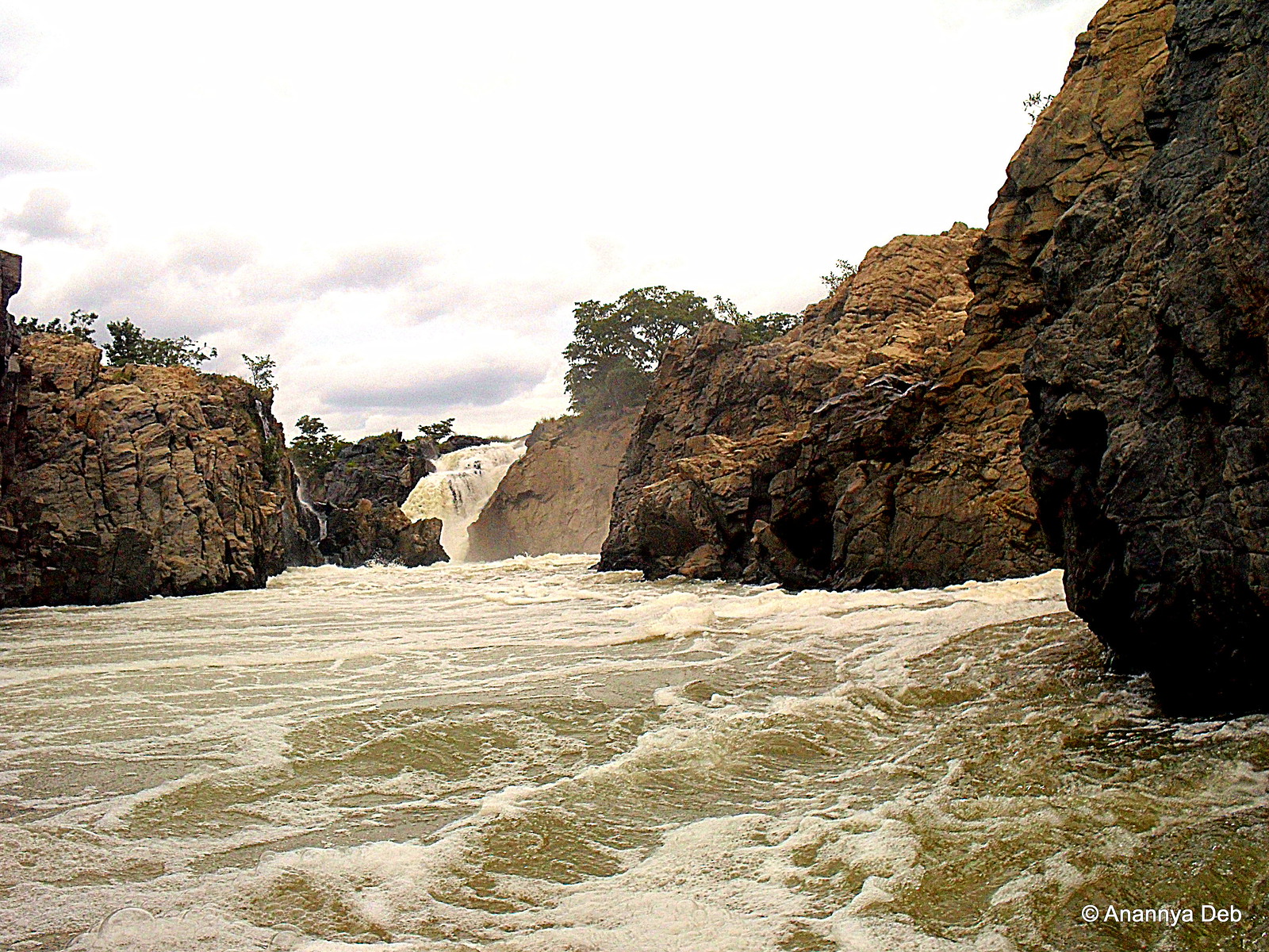
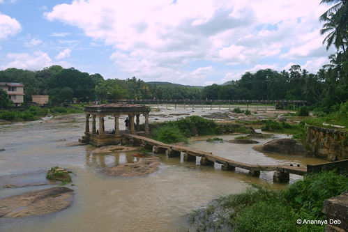
The Cauvery turns into Tamil Nadu from Karnataka. The river breaks into multiple streams and rapids as the waters weave around the rocky terrain. The coracles operated by boatmen here takes one right into the zone. There is a loop that the boatman takes which includes a bit of rock climbing (with boat hanging over the back), jungle trekking and lots  of white water paddling.

3. Bangkok, March 2011

Wat Arun, Bangkok, March 2011 
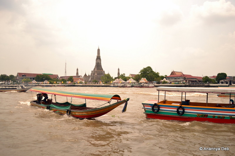
The Chao Praya river traffic is heavy as the traffic on the tar roads of the city. But with a lot of the city’s fine sights lined up on either side of the river, taking the water buses makes for a good joy ride as well as commuting option to go from one location to another.

4. Luang Prabang, Laos, March 2011

View from the boatman's seat, on the Mekong, March 2011

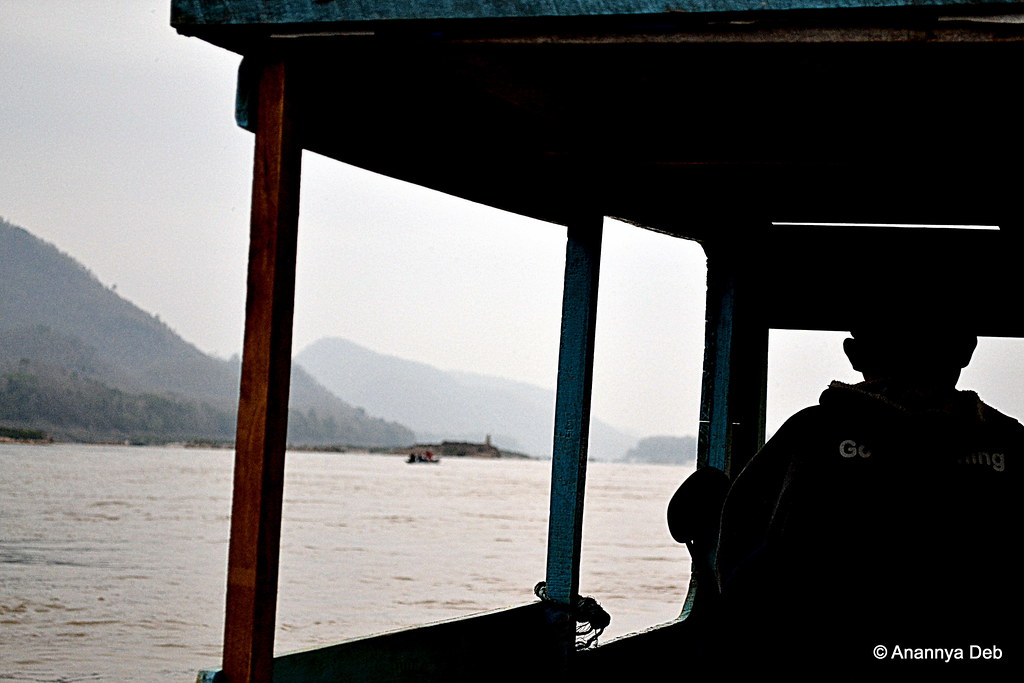
The mighty Mekong winds through the mountains of northern Laos and flows through Luang Prabang, former capital of French occupied Laos. All along the river, there are a number of tourist hops and these long tail boats ferry the tourists upriver and back. Early morning mist covers the mountains and the cool weather of the high altitude zone makes it a very refreshing ride.

5. Kong Lor, Laos, April 2011

On-coming boat traffic, inside Kong Lor, Laos, April 2011 This underground river Hinboun takes one deep into the dark rectum of a Kong Lor mountain. Tiny spots of lights from mobile phone torches and miner helmet lamps give glimpses of gargoyle like limestone formations on the walls. The entire boat ride – upstream and downstream – lasts a good 1 hour. There is no navigation, just follow the water. If you hit a rock, you go around and keep going. April is in the middle of the dry season and the water levels was low. This meant occasionally getting off the boat, wading in ankle deep water tugging the boat over the shoals till it became deeper.

6. Si Phan Don, Laos, April 2011

Mekong river bank, southern Laos, April 2011

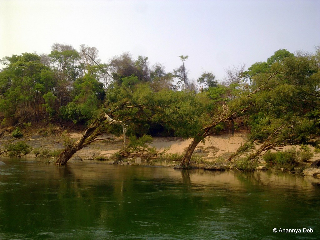
On the border of Laos and Cambodia, the Mekong spreads out into an area of over 14km in breadth. In the Ganges delta, the land appears and disappears with the tides. Here in Laos, the land appears and disappears with the flooding of the river. Hence, the name Si Phan Don or 4000 Islands. Here, approximately in the middle of the river, where the depth is sufficiently immense, roam the remaining few Irrawaddy Dolphins. From Don Det, the largest of the 4000 islands, one can take a long tail boat and go down to what the locals call the Dolphin stadium. Along the way, you see these trees bent over from the force of the flooded river over the years.

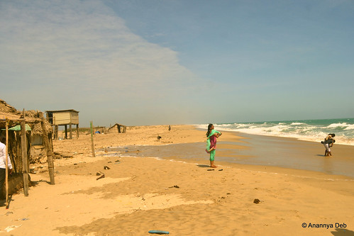
7. Pichavaram, August 2014

Pichavaram, August 2014 
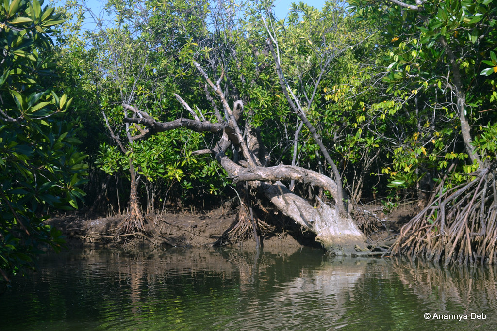
The mangrove forests of Pichavaram have some rare species of trees as well as a range of birds, permanent and migratory. The boat weaves around stands of these trees and visits the inner nooks and corners of the estuary. There’s fish to catch and eat.

8. Kochi, April 2015

Kochi Harbour, April 2015

Ports on the western coast of India have a long saga of maritime history. The ports of Kerala have seen trade ships from all parts of the globe for millennia. The various structures, water craft and random paraphernalia show evidence of all those influences in their design. The Fort Kochi – Ernakulam ferry at 4 bucks is the cheapest way to explore all that history.

9. Hue, Vietnam, November 2015

Hue District, November 2015 
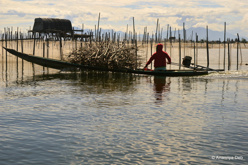
Just outside Hue, separated from the China Sea by large sand bars, lagoons provide fertile water plots for shrimp farming. The skyline is dotted with godowns, watch towers and restaurants (for tourists) built on stilts. Vietnam outside the cities, now that there is no war, is probably one of the most laid back and sleepy parts of the world

10. Tonle Sap, Cambodia, November 2015

Tonle Sap, November 2015

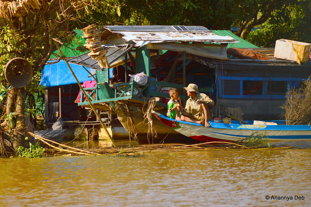
The Tonle Sap or Great Lake was the primary water source for the Angkor people back in the day. After all the upheaval that the land and its people have gone through, the lake today supports a diverse set of species living in or on it. This includes humans – refugees of all kinds. Homeless people who have lost their lands during the wars; ethnic minority communities chased out by the ruling regimes in Cambodia and Vietnam; migrants who cannot find any shelter in the already impoverished nation; and many others. The floating settlement – houses on stilts, traffic in jolly rowing boats – has taken care of itself with churches, schools, basketball courts, hospitals and their own houses, all floating in the water.

Bonus: Mumbai Harbour, all the time

Mumbai, December 2015

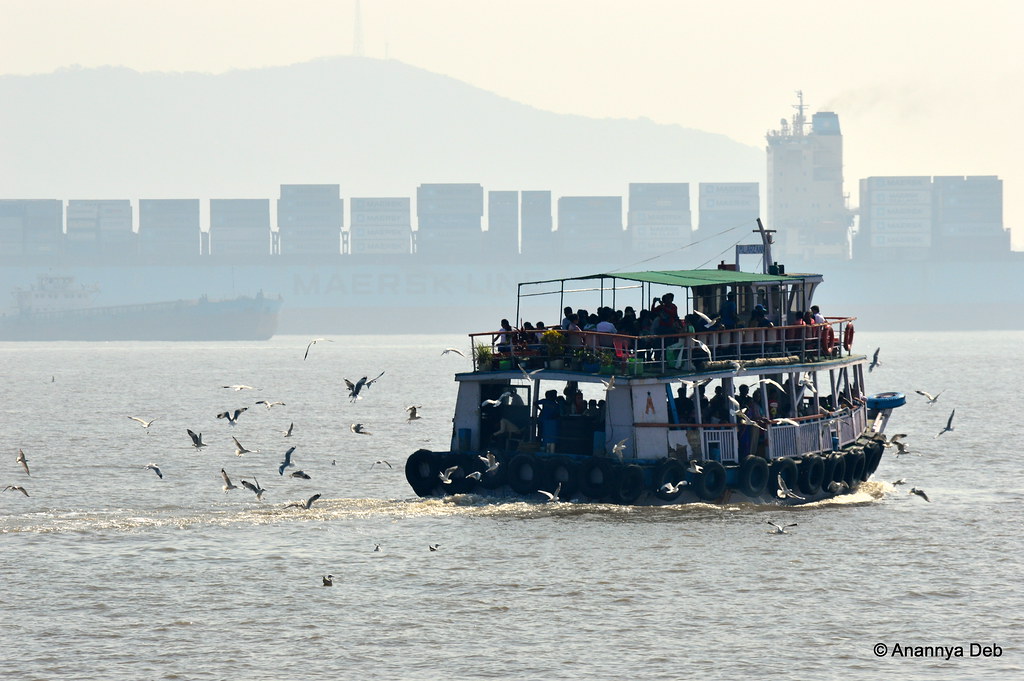
A boat ride in Mumbai harbour, whether for pleasure or for going across to Elephanta Island, is an experience that rivals rush hour commuting. There’s a million people out there getting into those boats. Boatmen have their safety norms and will not allow more than a certain number. So there is a fight on to take the next boat and be on one’s way. All this is of course great for the sea gulls. Kids and adults throw out pop corn, chips or biscuits for the birds to catch as they are flying. Thus this site of a plume of white seagulls rising around these harbour boats.

Ballimaran Se Dariba Talak

Tujshe milna purani Dilli mein
Chhod aaye nishaani Dilli mein
Ballimaran se Daribe talak
Teri meri kahani Dilli mein

From Ghalib’s haveli

1-DSC_0923

One steps out on to the street

Delhi, April 2016

on Gali Qasim Jan

Delhi, April 2016

through the narrow dark streets of Ballimaran

Delhi, April 2016

where boatmen once lived but over the years were followed by soldiers, hakims, Ayurvedic healers, jalebi makers, kabab walas, mattress makers, plastic suppliers and other people

Delhi, April 2016

with Mughal domes jutting out in the far distance along with electric cables, air-conditioner units and modified roofs

Delhi, April 2016

And of course Lal Kila stands in the distance at the Dariba Kalan corner on Chandni Chowk

Delhi, April 2016

To round it up, in my book, based on my limited literary sense, one of the greatest Gulzar compositions ever

Exploring Mumbai – 2015

This year, like in the previous years, I continued my explorations of this Urbs Prima in Mundis.

There will soon be more people living in the city of Bombay than on the continent of Australia. Urbs Prima in Indis reads the plaque outside the Gateway of India. It is also the Urbs Prima in Mundis, at least in one area, the first test of the vitality of a city: the number of people living in it. With 14 million people, Bombay is the biggest city on the planet of a race of city dwellers. Bombay is the future of urban civilization on the planet. God help us.

(Maximum City, Suketu Mehta)

All these people in the city means that when exploring the city with the camera, it is very difficult to get a chaos-less frame. Every direction, if one tries compose a shot, is filled with millions of photobombs – hanging wires, traffic, people walking by, hawkers looking for custom, dogs, cows and the ubiquitous black & yellow taxis and BEST buses.

Below are a selection of 25 photographs out of the many I took this year of different places in Mumbai.

February 2015

Mahakali Caves Road, Mumbai, February 2014
1. Mahakali Caves Road, Andheri East

The Mahakali Caves are part of the series of Buddhist caves in and around Mumbai. The series include Kanheri, Karla and Bhaja as the big ones with Jogeshwari, Mandapeshwar and Mahakali being the smaller groups. The latter three are now buried under slums with the enclosed area used as a public shit house. This picture of a mass producing statue workshop – of Dr Ambedkar holding a copy of the Constitution and pointing to Parliament (to be imagined I am sure) – provides some element of artistic gravitas to the other wise dump that this archaeological site has become.

March 2015

wp_20150328_012
2. Gol Deool, Null Bazaar

The area starting with Byculla all the way south to Kalbadevi has, for the last 200 years, financed the city. This centre of trade – cloth, diamond, precious metals, steel, paper, machinery and human flesh trade – has given the city many billionaires and millionaires through organised industry – legal and illegal. Today, the wealth creation has become more spread out and these old parts of the city like Null Bazaar look considerably rundown and decayed. But the stream of population remains.

wp_20150328_043
3. Mumbadevi Temple, Kalbadevi

The city’s eponymous temple is hidden by shops in a crowded lane of Kalbadevi. The vimana of the temple can be seen through the gaps from a distance. But upfront, the entrance is lost amongst the cloth and jewelry shops in the street.

wp_20150328_024
4. Madhavbaug, CP Tank

Mahatma Gandhi’s first few days back in India were spent in Girgaum in places like Madhavbaug where he attended many felicitation programs as well as delivered lectures and talks on his works. Behind Madhavbaug is an old animal shelter which was renovated and kept ready for the rush of old animals following the ban on cow slaughter in Maharashtra.

April 2015


img_20150404_175355391_hdr
5. Alfred Talkies, Maulana Shaukat Ali Road

The area around Bombay Central & Grant Road railway stations was a hub of the Bombay film industry till the 1950s. Cinema halls like Alfred Talkies were destinations for the cinema afficianados. Many like Minerva and Naaz which ran movies like Sholay for years are now demolished and are obliterated from the map. Those still standing cater to the local shopkeepers, taxi drivers and customers visiting the red light quarters on Maulana Shaukat Ali Road.

img_20150404_182545094_hdr
6. The Royal Opera House, Girgaum

The Royal Opera House of Mumbai is likely to reopen in 2016. Five years of painstaking restoration to its original 1911 design is heading into its last leg. Purely for its touristy value, a re-opened operational Opera House will be some achievement for a city which is losing all its heritage establishments one after another.

dsc_0043
7. Taraporevala Aquarim, Marine Drive

The Art Deco structures of Mumbai have been nominated for UNESCO World Heritage status. The Taraporevala Aquarium has got itself a new look with twinkling dancing lights on its facade. The Art Deco style has been preserved but for some reason, one feels the visual appearance has a strong Govinda meets MF Hussain feel.

dsc_0068
8. Marine Drive

Ah! Marine Drive. These days photographing across Marine Drive, a line of sight measuring 2 km, is difficult because of the pollution filled haze casting a veil on all the buildings. But Mumbai, even if it is choking in the crush of all things, finds itself magnetically drawn to Marine Drive and the seafront promenade every evening.

May 2015

img_20150523_180304495_hdr
9. Theosophical Society, Gamdevi

A small road bridge over the Western Railway tracks, sandwiched between the more busier bridges on Sardar Patel Road and Nana Chowk Road, is the French Bridge, named after Col PT French, one of the founders of the BBCI Railway Company (became the Western Railway after independence). The traffic is non-existent even though one end of the bridge comes out into the busy Opera House junction. At the other end is The Theosophical Society building which has a hall in it called Blavatsky Lodge. This structure hosted many personalities over the years including Mahatma Gandhi. Some significant events, declarations and meetings during the freedom struggle happened here.

img_20150523_180850524
10. Gamdevi

Girgaum or Gamdevi (literally, the “village goddess”) developed from the small village in the foot of the Malabar Hill. This is reflected in its name – Giri + Gaum i.e. hill village. This is feature of all parts of Mumbai which have grown from small villages like these. The local word for such villages is “gaothan” and the cross-hairs of many builders and developers are on these prime locations. The narrow zig-zag streets, small courtyards outside homes, chickens fluttering around – some of the typical “gauthi” elements still remain under the shadow of skyscrapers.

dsc_0192
11. August Kranti Maidan, Gamdevi

Bombay has been a significant centre for political events which were part of the freedom struggle. The Quit India movement which was launched here by Aruna Asaf Ali who led the Congress session since everyone including Mahatma Gandhi were arrested or detained by the British. The maidan is just five minutes walk from Mani Bhuvan, Gandhi’s residence in Mumbai for many years.

img_20150530_174647267
12. Kalbadevi Road

Kalbadevi is a fascinating place to explore – trading, old bookshops, art deco cinema halls, communes called wadis, shady bars, restaurants and a variety of small temples, mosques, agiaries and churches sprinkled all over. Each of these establishments have their own history and associated legends. If you can brave the teeming crowds, there are many a Saturdays which you can spend walking here.

July 2015

dsc_0356
13. Oval Maidan, Fort

I do my city explorations on Saturday afternoons. I get out of office early, pick a neighbourhood to explore and catch a bus or train going there. The Fort area on Saturday afternoons goes into a limbo state – there are half-day workers are rushing to Churchgate or CST to catch their trains home and there are some hardworking delivery people who settle down for a siesta in the edges of the maidans watching whatever game of cricket is going on – even kids doing net practice.

dsc_0342
14. Mumbai University, Fort Campus

The Fort campus of Mumbai University always makes one pause and look up when passing by.

dsc_0337
15. Kalaghoda

Kalaghoda lost two major addresses this year – Samovar and Rhythm House. What will come in their place?

September 2015

img_20150916_094430251_hdr
16. Eastern Freeway Tunnel, Chembur exit

My house is less than a kilometre from the Chembur exit of the Eastern Freeway. It has made Cafe Mondegar in Colaba my “will be right there” place. And in the monsoon, the tunnels have a touch of the Western Ghats aesthetic.

img_20150917_15305488825257e2
17. Horniman Circle, Fort

I have been to Horniman Circle so many times but till recently, I never noticed these Grecian faces on the columns of the buildings. One of the buildings is called Hermes House. So, in the absence of any expert reference, let’s assume these are Hermes busts. This year, there were not too many open air events in Horniman Circle.

img_20150917_17070803625257e2
18. St Thomas Cathedral, Fort

One of the first churches in Western India and Mumbai, Constructed in the 17th century, the St Thomas Cathedral was the first Anglican Church in Mumbai and served the British community in the original Fort. There are memorials and tombstones of British officers, their wives and their children since 1718. One can see the number of young Britishers perishing to tropical diseases before they reached the age of 25. There’s also a number of memorials for various crews of ships lost at sea off the coast.

img_20150917_192218948
19. Chhatrapati Shivaji Terminus

With the UNESCO World Heritage Site status secured, whoever is in charge decided it would be a good idea to bathe the iconic structure with disco lights. Not many citizens are impressed by it. The simple sodium vapour lights were far more elegant.

img_20150928_124910406
20. Lower Parel Skyline

Lower Parel was known as “Girangaon” – the village of spinning mills. The skyline was made up of tall chimneys. The chimneys have been replaced by residential and commercial blocks. Ever since they relaxed the maximum height of buildings, all the major construction companies were out there creating a race to the sky. Looking out of the 17th floor of one such building, one can still see a few pixels of ground. In another five years, I am not sure that the will be visible.

October 2015

dsc_0398
21. Bandra Railway Station

Apart from CST, some of the suburban railway stations have some very eye catching designs. The beautiful Bandra railway station is one. Though, with all the cables and skywalks and autorickshaws jammed on the roads, I am not sure how many people stop to appreciate the structure.

dsc_0408
22. Sachin Tendulkar Dedication, Carter Road, Bandra

There is this random bat installed on Carter Road. It’s a dedication to the greatest batsman in cricket ever. I found it quite clunky and ugly.

November 2015

img_20151128_182417092
23. Chhatrapati Shivaji Maharaj Vastu Sanghralaya

Visiting the CSMVS (formerly the Prince of Wales Museum), one notices that the disco lights bug has hit them as well.

December 2015

dsc_0595
24. The Taj Mahal Hotel, Colaba

December was a busy month and the only bit of exploration one could do was to take a day trip to the Elephanta Caves. A photograph of the Taj Mahal hotel peeping out of the trees came by habit as did the next one – the three headed sculpture of Shiva.

dsc_0672
25. The Three-Headed Maheshamurti in Elephanta

2016 beckons in a few hours and there should be some new places in Mumbai that I hope to explore soon.

Banavasi – capital of the Kadambas

This extremely small town (or large village) with a population of less than 5000 people has this one large Shiva temple built in the 9th century CE. Most vacationing people will simply ignore this and instead carry on towards Jog Falls. Which is fine. But for those who like to explore history on their travels, a short detour to this village is worth it.

As George Moraes in his Ph.D thesis work called The Kadamba Kula writes

“The History of the Kadambas is the history of one of the most neglected, though in its own days one of the most influential, of the dynasties that held sway over the Dekkan (sic).”

The news of the city had reached Ptolemy as well and we can find the town “Banauasi” in his Geographic works. During the third Buddhist Council hosted by Emperor Ashoka, a Buddhist monk Rakkhita was deputed to this town. Obviously, as George Moraes says, it must have been an important centre for someone to be specially sent for spreading the word. And about 900 years later, in the 7th century CE, Huien Tsang mentions visiting this place (called Konkanapulo) and finding over 100 monasteries (or sanghramas) with over 10,000 priests. It is believed that with Banavasi as the base, Buddhism spread to the Konkan and other parts of Karnataka.

The Aihole inscription describes Banavasi as a city “whose wealth rivaled the gods” and then proceeds to explain how Pulakesin II of the Badami Chalukyas vanquished the Kadambas of Banavasi.

Banavasi is located in north-western Karnataka, about 120 kilometres south-west from Hubli. To its west lies the Shravati Wildlife Sanctuary up in the Western Ghats which also is the home of the highest waterfall in India, Jog Falls. The town lies on the banks of the Varada river. Like most cities across the world, this city was also established on the banks of a river. In this case, it is the Varada river which is a rain fed river rising in the Western Ghats and flowing down the slope eastwards. The Aihole Inscription mentions that the river encircled a fortress and there were birds in the river which were trained to alert the soldiers in the fortress in case they were attacked. Pulakesin II of the Chalukyas was still able to defeat them and the Aihole Inscription carries on about his greatness. Being rain fed and with a number of hydro-electric dams built along its course, there is not much water left in the river, especially in November.

The Madhukeshwara temple is dated to the 9th century CE when the Western Chalukyas of Kalyani held sway over the land. But this temple may have been built over earlier structures as some of the inscriptions tell. Also there are various sculptures that depict different styles, namely the Kadamba, the Chalukya and later the Vijayanagara style.

Each of these styles are unique and the uniqueness is usually palpable. The main areas to focus when looking for uniqueness are a) the shikhara / vimana b) the general plan and c) the lesser number of sculptures. The Kadamba shikhara is typically a pyramid with stepped layers rising and tapering to the peak (see the picture above). You will also find Kadamba architecture in Belgaum, Belur, Halsi and Goa and other surrounding areas.

Exquisite stone work is on display like most other places in peninsular India. However, unlike the artwork in Hampi or Kanchipuram or Ellora or Pattadakal, the sculptures are extremely measured. There are sculptures of Nandi, elephants, warriors, gods and goddesses but each piece of sculpture has a lot of breathing space around it and often there are walls with nothing on it providing some relief.

I visited this town in 2013 in November. I took a state transport bus from Hubli to Sirsi, a 100km ride which took about 2 hours and a bit. From Sirsi, I took another state transport bus, but a very well decked tourist oriented bus to Banavasi, a 23 kilometre ride which took another 30 minutes. I started in from Hubli at 10:15am and I was in Bnavasi by 1.15, waiting time included. I spent 1 hour there walking around, exploring the temple and the village houses all around. By the time I finished, the next bus had arrived from Sirsi and I could take the same bus back and be on my way to Gokarna which was my main destination.

The whole village can be covered in a nice slow 30-minute walk. One passes through small institutes of art and culture including a Yakshagana theatre group. Today, there is a certain charm to this town. The old temple continues to conduct its daily rituals and hosts various festivals as per schedule. There are families coming over, one or two on a normal day, a few more on the weekend and a little more on religious holidays. But, it is a quite unassuming place. There is a resort there as well, on the banks of the river, and it advertises trips to the Jog Falls and the neighbouring forests.

Personally, the 1 hour I spent there was enough for me. It gave me what I wanted, a glimpse of what prosperity was in the first millennium and also a living proof of how a place goes into decline and fall once the political powers disappear. of course, I could tick off another important historical location in Peninsular India from my personal travel list

Viewing A Room With A View

In houses and palaces now abandoned, what did the people see outside their windows?


Amer Fort, February 2015
Amer Palace, Jaipur, Rajasthan

In Rajasthan, the kings and the queens could see their subjects in the distance. In the immediate foreground, they saw manicured gardens and still waters of artificial lakes.


Padmanabhapuram. August 2014
Padmanabhapuram Palace, (former seat of the erstwhile kingdom of Travancore), Tamil Nadu

Here, the king wanted to recreate the same experience as felt while seated on a howdah (on an elephant)


Cave 6 (Second floor), Ajanta, July 2014
Cave 6, Ajanta Caves,

The monks in Ajanta lived a sparse life as prescribed by their order. In the darkness of their caves, the world outside was, literally, a blinding light.


Mani Bhavan, Mumbai, November 2013
Balcony on the second floor of Mani Bhuvan, Bombay (Gandhi’s residence in the city)

Gandhi, when he lived in Bombay, stayed at a house loaned to him by a prominent local business man. It was located in a quiet lane in the middle of one of the most crowded areas – Girgaum. Even today, this lane, called Laburnum Road because of the flower trees growing here, remains quiet and uncluttered giving the thinking man lots of moments of peace on his balcony


Bijapur, March 2013
From the top of Gol Gumbaz, Bijapur

When sultans established their sultanates, they made sure that there were no competitors. This included rival buildings that occupied the skyline. The Adil Shah of Bijapur made sure there were no tall rivals to the Gol Gumbaz


Sabarmati Ashram, Ahmedabad, June 2010
Kasturba Gandhi’s room in the Sabarmati Ashram, Ahmedabad

Kasturba Gandhi had her own hut in the ashram. Gandhi’s hut with its verandah faced the river. Kasturba’s hut was placed the other way round with a window on the side looking out into the ashram’s open area. Gandhi could at least see the waters of the river flowing by.


The History of Mumbai in 10 Photographs: From The Ramayana to the Modern Age

At any given point in time, in Mumbai, there are multiple eras / generations / timelines existing simultaneously in the city, in a form that DD Kosambi called the “living prehistory”. Here are ten pictures from different parts of the city (and to be fair, one has to include a few areas outside the present day municipal limits).


1. The Mauryan era (Kanheri Caves, 2nd century BCE onwards)

Buddhism demanded detachment of all material pleasure. This meant settlements in natural environs like caves suitably modified to house thousands of monks. The infrastructural needs for monks were limited – a large prayer hall, various platforms for discourse, dormitories for sleeping, a common assembly area for meals and cisterns of water for all the usual ablutions. Having a river or any water body nearby was an added advantage.

Kanheri Caves has all of these. Over 120 caves are scattered over the entire hill in the middle of what is now the Sanjay Gandhi National Park. Various inscriptions on the walls of the caves date the caves from 2nd Century BC right up to the 10th or 11th century CE. The caves are located on an ancient trade route heading towards the port town of Sopara, a prosperous centre during the Mauryan era.

The well chiseled dormitories for the Buddhist monks and travelers at Kanheri


2. The Rashtrakuta Era ( Elephanta Caves / Island , 6th – 8th century CE)

The Elephanta Caves as a tourist landmark is quite a cliche. It’s quite boring beyond a point. I have been there three times now in the last ten years and I think I have had enough. But that is because of overkill. The sculptures themselves are magnificent. They recall very vividly Cave 29 in Ellora, also built around the same time under the Rashtrakuta kings.

The Five Faced Shiva, three faces sculpted here, the fourth face is imagined to be the one at the back and the fifth one is the invisible face
The original Elephant statue from the island of Gharapuri which took its name from this. The British tried to ship it to England but the crane tilted over, unable to handle the weight of the stone elephant. It was moved to the Bhaudaji Lad Museum (earlier known as Victoria and Albert Museum) in Byculla.


3. The Shilhara era (Banganga / Walkeshwar , 12th Century)

A tourist inscription at the Banganga tank retells a story from the Ramayana. Our three protagonists, having wandered here, were resting on the hill in Bombay island. Sea water is salty. So for looking for fresh water to drink, Lakshman did the old trick – he fired an arrow into the ground. And a spring erupted with fresh water. Since the only source of fresh water known to man at that time was the Ganga, it was believed that this spring was connected to the Himalayan river, thousands of miles away. Hence,  the spring was named Banganga. The tank structure per se dates back to the 12th century during the reign of the Silhara kings. They were the ones who brought in settlers from the interiors and soon, apart from the fisherfolk, there were all kinds of people from all the four castes doing their respective duties. The descendants of those early settlers – the Pathare Prabhus, the GSBs, etc. – are still amongst the key influencers of the city.

Today, Banganga continues to house some of those ancient structures in the form of gates, pillars, the occasional memorials and inscriptions. There does not seem to be much change in the routines of the various temples. Of course, modernity has allowed for loud speakers and musical accompaniments made up of mobile phone ring tones.

In this picture, like in any archaeological excavation, one can see the layers of time in the different structures – from very ancient steps to the more modern high rises.

Banganga Tank in the evening: Literally the local watering hole


4. Sultanates of Gujarat & Deccan era (Mahim – Worli, 15th century)

The island of Mahim, along with the other islands, came under Islamic rule for about 200 years. In the 14th century, the Sultan of Gujarat defeated the Shilharas and took over the island of Mahim. All the islands that made up the Bombay archipelago were ideal for shipping and all those involved in the west coast maritime activities tried to gain a foothold in one or more of these islands. The Sultan of Gujarat was one contender. The Bahmani sultanate was another. There was the famous Ahmad Shah (Gujarat / Ahmadabad) versus Ahmad Shah (Bahmani / Ahmadnagar) battle over Mahim in the 15th century. The Gujarat side won. In joy, Ahmad Shah of Gujarat built a number of mosques on land and on sea.

View of Haji Ali dargah, built 15th century by the Sultan of Gujarat


5. Portuguese era (Bandra Fort, 17th century)

Castella de Aguada was built in the 17th century by the Portuguese as a watering hole for ships (there were a number of fresh water springs here) and later as a bastion against the British who, apart from territorial victories through local battles, had taken over the other islands of Bombay following the marriage of Charles II. The Portuguese had earlier, in 1517, taken over the Mahim fort from the Sultan of Gujarat. The St Michael’s Church in Mahim dates to this period. As the seven islands of Bombay were handed over to the British, the Portuguese retreated northwards to Bandra, Malad and Bassein (Vasai) where it continued to reign for another century or so.

From Dadar right up to Vasai, one can trace a whole line of extant churches built in the 16th and 17th centuries by the Portuguese. Of course, their legacy also lives in the ubiquitous vada-pav where both the potato and the bread were introduced by them.

The Bandra Fort Auditorium where there are couples trying to find corner seats everywhere


6. British era (St Thomas Cathedral, 18th century)

When a power establishes themselves in any place, they show their supremacy by building a religious institution. The Hindu empires built all those temples in South India; the Mughals built all kinds of mosques at various places after victories in battles or the like. The British did the same in every city they took over. St Thomas Cathedral in 1716 was the first Anglican church in India and it capped the complete control of Bombay that British now secured for themselves.

The first church, a monumental one, obviously becomes a landmark. And so it lends itself to Churchgate, the railway station complex that stood outside the fort gate facing the church.

St Thomas Cathedral, much renovated and repaired, is now hidden amongst the taller structures like the BSE.


7. Gandhi & Freedom Struggle (Mani Bhavan, early 20th century)

The two storey house originally belonging to Revashankar Jhaveri is now part of a network of Gandhi memorials across the country which includes the Sabarmati Ashram and places outside India as well.

The room in which Gandhi stayed in, like all the other memorials, is arranged in the same way – mattress or rug on the floor, a writing table with paper, quills, blotting paper, etc, a spinning wheel on the side and other small stationery items. You will find this arrangement in Sabarmati, at the Aga Khan Palace in Pune, in fact anywhere and everywhere that Gandhi stayed in.

Gandhi’s room on the second floor of Mani Bhavan, preserved with air conditioning.


8. The Marathi Manoos era (Shivaji Park, 20th century)

Open spaces are rare in Mumbai. So the existing open spaces have high emotional value.  Shivaji Park, like similar features in other major cities, has been the hub of both social and political movements in Mumbai. While the maidans of South Mumbai are associated with the British, Shivaji Park, even though it dates back to 1920s, was always associated with, first, the local nationalist movement and later, the Maharashtra movement. Back in the 1950s, this ground was the venue of meetings and demonstrations related to the creation of the Marathi speaking state. Because of that legacy, the May 1st (Maharashtra Day) parades and celebrations are held in Shivaji Park and not anywhere else.

Apart from cricket, Shivaji Park also hosts other sports


9. The Bombay Talkies Era (Maratha Mandir, 20th century)

The cinema halls of south and central Mumbai reflect the many evolutions in the city – the movement of people to the northern suburbs leading to lesser patronage, the rising inflation leading the asynchronous economics where the extant pre-independence era monthly rentals from these old properties don’t even cover the cost of a single show, the flux of soft core regional language movies which keeps ever increasing migrant population made up of taxi drivers and restaurant waiters happy. Some of these cinema halls have, of course, made their sorry state into a tourist attraction.

Maratha Mandir where people used to come in elephants for premieres now becomes a tourist spot for showing the same film for almost 20 years now.


10. Vertical Era (Mumbai Skyline, 21st Century)

The recent freeing up of FSI means builders can go higher and higher. Not just buildings, even roads and transportation services are going above ground.

The Eastern Freeway is an elevated road bypassing all the slums below. A monorail runs above the Freeway and there are high rises on either side. The faux Shanghaification of Mumbai is on

I will update this post with new pictures from further explorations of Mumbai one year later

New Places Visited in 2014

As the year comes to an end and there is not much travel (work or leisure) planned for the rest of the five weeks left in the year, a summary of some of the new places visited this year.

Meerut

I was in this town for just a couple of hours on work. As one drove in, through sugarcane fields, the first things one sees are the billboards of cricket bat manufacturers. Meerut has over 50 of the top sports goods brands, brands which many would have seen on the bats of cricketers or the sticks of hockey players or would have purchased for their kids from the local toy or sports shops. Then you enter the old town where the traffic has not moved since the 1857 War of Independence. Meerut was one of those many towns which fell to the Indian sepoys and there are a number of memorials to the martyrs all over the place with a bulk of them in the Meerut Cantonment area. There is a special park for Mangal Pandey as well.

It was late winter when I went there and the weather was just right for chai under the trees.

Meerut, February 2014

Lucknow – Kanpur

Another work trip, so there wasn’t much time to spend looking around the city. But the early mornings, a walk along Hazratganj offered some opportunities for photography. Dinner was, obviously, devoted to kababs and more kababs.

Hazratganj, Lucknow, April 2014

Hazratganj, Lucknow, April 2014Kanchipuram

Kanchipuram was a half-day work trip but there was just enough time to indulge in some history stuff. The Pallava era structures of Kailashnatha and Ekambareshwar were visited. Another former imperial capital city in India was ticked off from the must-visit list. And sumptuous non vegetarian meals were had at Rama’s Mess.

Kanchipuram, February 2014

Kailasanathar, Kanchipuram, February 2014

Ranchi

Ranchi, the town of the second most important and powerful person in India, is a lovely small town with a small lake which the local cab driver proudly says is as big as the sea and a single long road which winds through the city linking the older parts of the town with the modern industrial areas. It was quite a pleasant surprise to see a prominent city square in an Indian city named after an Indian Army soldier, specifically a PVC.

Ranchi, March 2014

Ajanta and Ellora

I had Ajanta and Ellora on my list for a long time. I decided to just take one weekend off and go and do it. And it was worth it. It was in the middle of the monsoon and the intermittent rain along with the lower temperatures made cave exploration much more bearable and fun.

Ellora, July 2014

Ajanta Caves, July 2014

While Ajanta and Ellora were the main targets of the trip, one also managed to have a look at Khultabad and Aurangabad. The walled city of Aurangabad is an interesting subject in itself, for those interested in the evolution of cities.

Southern Tamil Nadu

I spent two weeks roaming around southern Tamil Nadu – Chidambaram, Thanjavur, Rameshwaram, Kanyakumari, Madurai and places around them – and there is a whole list of new places there. A lot of stuff has been blogged about and one can read them here.

There hasn’t been much traveling since then. I suppose it’s now over to 2015 to see what is in store for me.

The Tamil Nadu Diaries

Since my 15 day trip in the southern state, I have been posting in various places random bits, mostly photographs, from the trip. Here is a full compendium of material from the trip.


The Trip in Brief

I have charted my itinerary on Google My Maps and it will give you an idea of the route I took.  I traveled by state transport bus – the Ultra Deluxe and Deluxe variety run by SETC and TNSTC. Just two of the journeys were by train – Thanjavur to Tirunelveli, an overnighter on the Trichendur Express and Kanyakumari to Rameshwaram, another overnighter which turned out to be 4 hours late in arrival. I stayed in hotels near the bus stands with hotel rates varying from Rs. 400 to Rs 1800. I did opt for A/C rooms at a few places given the intense heat in August but found reasonably priced hotels in the range of Rs 1000 – Rs 1200 for a single occupancy A/C room.

Traveling around the state was a very pleasant experience but for the heat and the lack of non-Tamil signage in the bus stands.


Highlights (blogged on my Tumblr photo blog)

Sunset in the paddy fields – returning from Pichavaram to Chidambaram town, as the bus halts to pick up passengers, the paddy fields go through the motions of yet another sunset.

The Sisyphus-like task of maintaining heritage – at the Thanjavur palace, a thunderstorm led to the collapse of one wing of the Mahal. Conservation is still a work in progress.

A window framed by the ambient light – at the Gandhi Mandapam in Rameshwaram

Howdy from the Howdah – the window seat of the Maharajah of Travancore at Padmanabhapuram Palace

A contrast in aesthetic quality of structures, separated by the width of a river and a few hundred years – at the Thiruparappu weir / waterfall on the Kerala – TN border

Unknown memorials to the sea – a rudimentary structure of stones or concrete blocks with a small piece of metal on top, resembling a Christmas tree, a tombstone and / or a church steeple found in Dhanushkodi.

Anti-vandalism movement in Madurai – an effort by the archaeology department that, unintentionally, vandalised more than it reduced.


Historical Analysis

In this trip I have ticked off all the UNESCO World Heritage Sites in South India, at least the structural types. There is still the Nilgiri Mountain Railway to take as is some of the deeper reaches of the Western Ghats. The last of the structural kind to be ticked off the list were the Great Living Chola Temples. Watching the three monumental structures, I penned together some amateur historian field notes here, mostly about how the relationship between ego and the colossal size of the structures.


Photo Albums

Chidambaram: A town as old as time – when you read more legends about a town than there are people living there, you just simply forget about figuring out its history.

Chidambaram, August 2014


Thanjavur: A historic city, significant in its influence in the area of art and till today the centre of many exquisite forms of artisanal craft.

Thanjavur, August 2014


The Great Living Chola Temples: The big temple of Thanjavur overlords the other two but each one of them pwns most structures in India including some of the Mughal ones.

Big Temple, Thanjavur, August 2014


Kanyakumari – I didn’t like Kanyakumari one bit, apart from view of the bay, the sea and the ocean merging together and the general feeling of awe when standing at the southernmost point of India

Kanyakumari, August 2014


Padmanabhapuram: When Marthanda Varma consolidated his territory and formed the state of Travancore, he located his capital in this town of Padmanabhapuram, named after the ruling deity of the family. A palace built of wood remains to the day but the town has now become a village serving the occasional tourists

Padmanabhapuram. August 2014


Thiruparappu: Thiruparappu is an ancient town on the river Kothayar, about 20km north west of Padmanabhapuram. It is nestled in the southernmost of the Western Ghats along the TN-Kerala border. On one side of the river is an ancient Shiva temple with stone gateways leading to the river. Towards the north is a weir controlling the waterflow and directing it to a fairly decent and powerful waterfall.

Thiruparappu, August 2014


Dhanushkodi and Rameshwaram: The two, just 20 kilometres apart, represent two opposite ends of the survival index. Dhanushkodi is a ghost town, destroyed by the cyclone in 1967. Rameshwaram smaller than a Mumbai suburb is bustling with fishing activity along with the regular surge of pilgrims to the temple.

Rameshwaram, August 2014
Dhanushkodi, August 2014


Madurai: A historic town, the heart centre of Tamil Nadu, Madurai is both a modern city with its cafes, neon lit stores, stylish people and so on as well as a culturally orthodox city with its temples, body stained religious devotees and the smell of burnt ghee from the sacrificial fires all over the town.

Madurai, August 2014


Tranquebar: Tranquebar, the former Danish colony, is called Tharangambadi, the land of musical waves and is preserved as a heritage town. The whitewashed buildings, mostly churches and schools still in use, make it quite attractive to look at. It is a very small town and in 20 minutes, you would have walked round it almost twice.

Tranquebar, August 2014

Got any questions? Do ask.

The Walled City Gates – Transit from one age to another

The walled city in India can be found across the country. Their age varies from the ancient (Harappan age) to the modern (British age). But the physical walled city disappears in no time. As populations rise, people spill over to live outside the city. Walls are demolished and the city area expanded to cover the new colonies. And every now and them, some superior power comes in and conquers the city and in the process of leaving one’s mark, the conqueror will create a new walled city and the old one will either be subsumed into the new one or be simply abandoned. Delhi has had its share of walled cities and one can easily remember the dynasties that ruled Delhi by looking at the listing of all those sites.

In post-independence India, the crush of ever increasing population, both through higher birthrates and even higher migrations has made these walls and gates an impediment to urban expansion and renewal. Bombay lost its walls in the 19th century itself when the British increased their holdings there. In the soot and grime of the city, these old walls look no different from the decay and dilapidation of urban housing, the only difference being that the more modern urban structures, one can say, can collapse on their own, given the quality of civil engineering and materials used these days. The old walls, however, still remain and will continue to remain till someone takes a stick of dynamite and blows them up. Remember, these walls were meant to withstand the blows of battering rams and cannon fire.

The city of Aurangabad came to being in the 17th century with Malik Ambar (a most fascinating gentleman who easily fits into any rags-to-riches story template – I am gathering various literatures about him and will do a post on him and the different places associated with him) and kept evolving with interventions by Emperor Aurangzeb, the various Nizams of Hyderabad and more recently by the local city and state governments. Over this period of evolution, Aurangabad has had over 52 gates. It was not just one large walled city but a network of walled suburbs and mohallas linked to each other through these gates and bridges (puls).

Aurangabad, July 2014

Off the 52 gates, there are four which are on the cardinal points. The gate facing North is obviously called Delhi Gate. In the same manner, the gate facing west (in the picture above) is called Makai or Mecca Gate. There’s a cannon fitted on top of the gate. The biggest threat to the city came from the west, the Marathas. A photographic census of some of the surviving gates of the city are available in this blogpost by Neha Kulkarni (which I found through a Google search).

As a traveler, the fun of visiting old walled cities is to see the shifting age. There is a clear change – in the language, the manners of the shopkeepers, the signboards, the people and of course, the physical cityscape that one gets to see. It is not necessarily cleaner, rather, in most places, it is filthier, more crowded and full of noise. One of the best places to experience this transition is to go look at the markets in the walled cities. The old signboards promising products of days gone by, their descendents doing trade in almost the same products, displayed on their shelves, each item an antique, a relic in itself.

Kalaghoda, February 2014

In Bombay itself (above picture), new age designer boutiques occupy the 19th century structures which have been given a nice coat of paint. Sharing a street with a synagogue which is a regular stop on the popular Kalaghoda Heritage Walk, these designer boutiques try to blend in with retro interiors, shop lighting and their display signs, all of which designed with excruciating detail. Had they been located in the more modern malls, they would obviously have taken a different approach to their shops.

In the Deccan Peninsula, my favourite historical haunt, there are a number of walled cities which live two lives – Bijapur (I wrote about Bijapur’s twin identities last year), Bassein / Vasai, Hyderabad, Belgaum, Pune, Ahmadnagar and so on.

Bijapur, March 2013

I really enjoyed exploring the old parts of Bijapur, especially streets like these – a typical gate at the end of the street and extremely quaint houses lined on both sides. While the gate in the distance is from the 16th century, the houses themselves are more recent – early 20th century – a very clear example of the continuous evolution of a city.

Back in Aurangabad, while walking, I came across this junction (picture below) where Dr BR Ambedkar stands tall and points the way to the university which is named after him. And on the entrance is a gate. This gate serves as a different transition point, I suppose. It takes you from the big bad world into the dreamy world of students and their lives.

Aurangabad, July 2014

The 52 gates of Aurangabad does not include this gate though. But it should. There is nothing which says modern day structures cannot be considered as part of the history.

History Travel – The Buddhist Cave Monasteries of Maharashtra

In the previous post, I had written of the seclusion of the cave monasteries in Ajanta. In this post, I write about the exact opposite – the open, easily found monasteries between the Arabian Sea in the west and Ajanta in the east. As a traveler with a bias towards history, if I plot the various Buddhist monasteries of Maharashtra that I have visited on a map, there is an interesting observation that I make which, after reading various literature and historical studies, seems to have a clear explanation.

Starting with Kanheri in Mumbai, there is Karla (8km from Lonavala), Panduleni (Nashik), Ellora (about 10 caves) and finally Ajanta. (There are many more like Junnar, Aurangabad, Bhaja, etc. but since I have not yet visited them I will not talk about as yet. )

These five spots, when plotted on the map, reveal that they are on two lines going east from the sea – one going North East, the other South East. They run in the same direction as two major highways which emanate from Mumbai – NH3 and NH4. The ASI informs us that this is not coincidence. In effect, there were ancient trade routes from the port town of Sopara (present day Nalla Sopara) which connected with the great cities inland include Pratishthana (modern day Paithan) which was the capital of the Satavahanas who reigned between the 3rd century BCE to 2nd century CE. The immediate conclusion is that, like the serais on the Silk Route, these monasteries were specially constructed on these trade routes and served as rest places for traders.

The Western Ghats is filled with over a 1000+ such sites. And the story seems to be same for all of them. Here is an excerpt from Sukumar Duut’s Buddhist Monks and Monasteries of India.

The Deccan Trap is comparatively soft. If the monks wanted retreats on the mountain-sides, the wealthy monks would not be wanting to build them. There were winding passes and traffic for the flow of internal trade and traffic. Places, not to distant from these routes yet a suitable remove to be secluded were naturally favoured. 

Buddhism had its golden period once Ashoka embraced and spread the Dhamma through his numerous rock edicts. As it became the religion of the people, Buddhist cave monasteries became not just residences for the practicing monks but also places which offered a number of services to the public who were of diverse background – traders, noblemen, commoners. The inscriptions in the various monasteries suggest that apart from kings, wealthy traders and noblemen donated to their excavation and construction of the various viharas and chaityagrihas.  In doing so, they thus sponsored the best craftsmen to conjure up all the classic sculptures and art that you can see in these monasteries.

So with this in mind, one can now look at the different embellishments done at these caves and try to imagine how they may have served both the monk looking for seclusion and the weary traveler looking for rest and recreation (and some mental happiness).

First of all, the size of the prayer hall (chaityagriha) at Kanheri and Karla are among the largest of all the cave monasteries that have been found. With a wide courtyard in front, this particular facility is well suited for large gatherings to assemble and mingle freely with ample space for everyone.


 The chaityagriha of Kanheri

Kanheri Caves, Mumbai, December 2011

The great hall at Karla
Karla Caves, June 2014


For the seclusion of the inmates i.e. the residences of the monks, once you turn round the curve and go deep into the hill, you see a whole warren of caves. They are distinctly invisible from the road below and even from the main prayer hall, they require a little effort in climbing up. Thus both the needs are met. Similar concepts can be found in design of many modern day educational complexes where the main classrooms and office buildings are easily accessible from the road while the rooms for the faculty and the students hostels are hidden somewhere at the back.


 The viharas (residences) of the monks at Kanheri

Kanheri Caves, February 2014


And what about the ornate artworks? Almost every cave has a recorded history (through inscriptions) of excavations and modifications ranging from 500 years to over 1000 years. During this period, Buddhism also saw a transformation from the more austere Hinayana to the more extravagant Mahayana where the likeness of the Buddha could now be carved out in various forms. Just like the Renaissance period in art came from the need to illustrate and bring to life stories from the holy book, the Mahayana period saw craftsmen bring out the different stories, themes and ideas of the Buddha and Buddhism in stone form (and mural work in the case of Ajanta).


Sculptures at Panduleni (Nashik)
Buddhist Art, Pandavlena Caves, Nashik, August 2010

 Sculptures at Karla

Karla Caves, June 2014

Cave 1 in Ajanta – the iconic paintings flanking the Buddha

Cave 1, Ajanta, July 2014


As a history buff, making this “trail” albeit  serendipitously  provides a nice sense of achievement for me. Instead of randomly visiting discrete places, there is a nice thread emerging out of these visits. There are some trails which I have been following quite consciously – like  visiting  various imperial capitals in the Deccan peninsula and so on. But this particular discovery for myself feels good.